Author: admin

Whiteface

“On the path that leads to Nowhere I have sometimes found my Soul.” Corinne Roosevelt

Mt. Whiteface (4310)

Trail: Blueberry ledge trail, & Blueberry trail cutoff.

Date: Sep. 1’st 1999

Attending: Gabe, Simone, & John Chicoine

Miles:8.5 Round tripTime: 4hrs up, 7.5hrs. total

AMC huts, / shelters / camping site: Mizpah

Weather: Sunny hot, 80 – 85

A 3 hour long car ride to Rt. 113a, by the Squam lakes area. Whiteface towers over a town-ship called Whiteface but it’s not listed on the map. (Like Otter River). There are only a dozen or so visible houses that make up the town but there seem to be hundreds of homes hidden in the woods. The parking lot for the trail-head is next to a nice field and an old hidden cemetery that looks like it’s just part of the horse farm. This was one of the first hikes ever that we didn’t see anyone on the trail. The cutoff trail follows a brook for ½ a mile then ascends more steeply than Blueberry ledge trail, (we found this out on the way down). But either trail is slightly more than a gentle walk in the woods. After two miles the trail is moderate to steep for another mile. The last section of the trail to the summit is quite steep scrambling up ledges with some hand over hand sections. There are only a few sections with views but they are very nice. We ate just 1000 ft. from the open ledge south summit where two trails intersect. We needed the rest.

The south summit is beautiful facing the lakes region with views all the way to Concord NH. The true summit is a spot on the trail 3/10’th of a mile on the trail to MT. Passaconaway. There is a campsite / hut that is Whiteface’s claim to fame. The hut is the ugliest hut in the Whites. We took the Blueberry Ledge trail down to the parking lot. From the Intersection of the cutoff and the trail, it’s two miles but it is so easy that it only took 40 minutes to get to the bridge at the start of the trail that we washed our feet in. I was really disappointed that the trail didn’t connect us up higher to the river (no houses) where we all really needed to fully immerse just to cool down. But we washed up under the bridge in a not so nice part of the brook surrounded by the front yards of several nice old homes. This would be a good approach to Mt. Passaconaway. But I doubt we’ll do it on so hot a day that we’d really consider full immersion.

Owlshead

“It is not so much for its beauty that the forest makes a claim upon men’s hearts, as for that subtle something, that quality of air that emanation from old trees, that so wonderfully changes and renews a weary spirit.” Robert Louis Stevenson
 

Owl’s Head (4025)

Trail: Lincoln Woods, Franconia Brook, Lincoln Brook,
Owl’s Head Slide & Franconia Brook Falls
Date:
September 9 & 10, 2000
Attending:
Shawn White, Gabe, Simone, & John Chicoine
Miles:
18.6-miles Time: Time: 12 hours of hike time
AMC huts, / shelters / camping site:

Weather:
Day 1: 9/9. Partly sunny. 40’ish at night.
Day 2: 9/10. Mostly Sunny, 75’ish both days, Dry air!

Peak Number 37 of the quest. What a delightful trip this was. The trailhead starts at the Lincoln Brook Ranger Station just a few miles out of Lincoln center on the Kancamagus highway. Once over the first suspension bridge at the visitor’s center the trail is a very heavily traveled abandoned railroad-bed that climbs at a steady 3 degree incline for 3 miles. At the end of this section (once you cross the next suspension bridge), the serious hiking trails leading into the Pemigewasset Wilderness truly begin. One notable feature at this point are the Franconia Brook Falls just down a side spur, 0.3 miles, before you cross the suspension bridge. (We can vouch that a quick dip in these cool pools of running refreshment can erase a entire weekend’s worth of trail stress and make you born-again. It’s just like how it feels in the spiritual sense, only in the physical.)

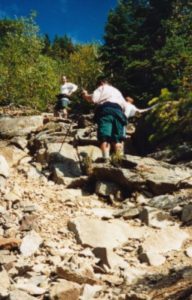
The rest of the 5 miles out to the base of the Owl’s Head Slide is another amazing foot path that manages to maintain the same steady 3 degree incline as the first 3 miles. This long stretch of trail through spectacular hardwood forests is broken up into small sections by lots of river crossings that help you mark your progress. There are several campsites located along the riverside within the last ¼ mile before the slide. None of these sites meet the 200 ft. limit from the water, but we were happy to have one so close to our destination. The Slide is a steep and dangerous rock scree scramble that extends over 60 percent of the total elevation of this climb. Footing is difficult, falling debris is inevitable and the pitch is challenging. (One comforting aspect of the slide is that it’s seldom over 20ft wide so it doesn’t feel as dangerous as it might if the slide were a wide open area.).
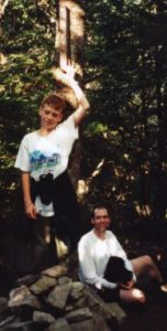
Once past the slide, the trail continues steeply for another several hundred yards through the forest over lots of blow-downs. It then levels off and continues for a few more hundred yards to the true wooded summit.

Gabe and Shawn at the summit

Once you have successfully bagged your peak and hiked down the slide, the rest of the trip seems long, but all down hill. You can simply zone out and put one foot in front of the other, mile after mile.

The weather for our trip was absolutely perfect. Just enough clouds to provide the necessary relief from the sun. The temps never reached over the seventies and there was this wonderful dry breeze that would gently blow through the hardwood forest now and then. The five or six river crossings were more than safe at summer water levels and hiking an 8 mile trail that follows water 90% of the way is such a blessing not to have to carry more than 1 liter of water at any time. Speaking of all this water, I suspect it would be worth checking recent rain falls before planning this trip.
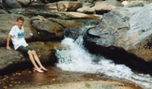
Lots of nice river spots like this.

Our site was just a few hundred feet from the base of the slide and just 50 feet from the Franconia Brook. We got to the site just as we planned at 2:00, after 4 hours of backpacking. We set up our site and after a quick lunch we headed up the slide at 3:00. The slide was a tough hike but afforded great views of the Franconia range. This was our first hike of the year that we actually had any views! I could hardly keep up with the rest of the crew. An old groin pull had started to act up and I happened to piss off a yellow-jacket half way up the slide. He figured a sting to the center of my right calf would be justice enough. Hiking down the slide we met up with a few of his friends, but none of us got stung. We got back to the camp just a bit after 6:00.
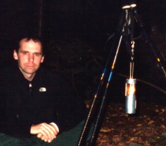

This was a “special occasion” trip. We wanted to celebrate Shawn’s new full time high school math teaching position in the Townsend school system. We packed in 4 Hostess cup cakes in a Tupperware container, and lit candles on them for a surprise celebration. After the usual Knorr/Ramen noodle soup dinner we set up a hiking pole tripod and hung a camper’s candle to give the campsite a warm glow. We turned in at about 8:30.

The morning after a quick breakfast of Poptarts, oatmeal and tea, we hit the trail at 8AM hoping to be back at the car by 12:00. We saw 14 people hiking to Owl’s Head on Lincoln Brook trail by 10AM on 9/10. At the suspension bridge just before starting our long slog down the 3-mile long railroad bed, we stopped for some water and snacks. We were all basking in the good feelings about this hike and not ready to see it end just yet, when we saw a large family group that hiked all this way and head for Franconia Falls. Suddenly it occurred to us that maybe there might be something worth seeing out there; even if people with walkmans, cell phones, beepers, Igloo coolers, and Nike’s were going there. We all decided to extend the hike another .6 miles to see what Franconia Falls was like. Wa-hoo!
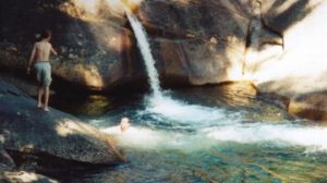
It was well worth the trip. Cold or not, nothing was going to stop any of us from a quick dip in the river. There are lots of spots to explore and get cooled off in. After drying in the sun for a few moments we packed up again and headed out. We saw at least another two dozen walkers/day hikers heading to the Franconia Falls area. We were glad to be going in the other direction. None of us really wanted the feeling to end, but all of us were glad to see the bridge at the Lincoln Brook Ranger station.
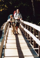
We stopped in Lincoln for a Pizza before we started the 3-hour drive back home.

Shawn, if you ever get on-line to read this; From Gabe, Simone, and me,,,, It just wouldn’t have been the same experience without you. Thanks for coming out with us on this one. Hopefully we’ll do a lot more hikes together.

Gary, if you’re reading this,,, You would have loved it. If there is one lasting down side to this trip, it’s that you couldn’t be there to share the experience. That’s from the heart of all of us.

Waumbec

“Life is not measured by the number of breaths we take but by the moments that take our breath away.”
Unknown

Mt. Waumbek (4006)


Trail:
Star King Trail
Date:
Sunday, March 16’th 2003
Attending:
Gabe, Simone and John
Miles:
7.6Time: 4.75hours
AMC huts, / shelters / camping site:

Weather:
Mostley sunny, high 50’s at the base, 40’s on the summit

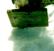
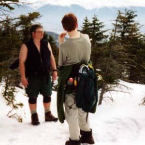
That sign on the Top of Waumbec is eye level in the summer! That’s one of the best parts of what this hike was all about! # 47 for us. The first White Mountain’s hike of the 2003 season! Hiking season is definitely here. The snow was great; the trail was very well packed in. Someone on a snow mobile had packed the first mile of the trail. We even saw Ski tracks from a few days before we had hiked. As the sun warmed the trail in the late afternoon we post-holed a few times in the col, but the Northwest side of Star King was pretty solid. The top 1-inch of the surface snow on the trail softened up enough to boot ski lots of the way down. The hike took us 2hrs. 45min. to reach Waumbec, it only took us 1hr. 45min, to get down. Gabe and I did a lot of intentional boot skiing down the side of this mountain. The temps had warmed up the snow enough to give it just the right consistency to get about 6 or 7 feet out of every lunge. This trail is 2.6 miles of steady moderate hiking up to Star King summit, and a moderate hike through the col between Star King to Waumbec. If there is a safe winter hike to take of the NH 4K’s this one is of the safest (longer but safer than Tecumseh).


I suspect it might be a bit boring as a summer hike. The entrance to Star King Road which turns into Star King Trail is just 200 yards East of the junction of 115A on Rt. 2. We only saw 2 people on the trail all day; A father and his 9 year old son that was on his 46’th 4K, and was hoping to finish the list before his 10’th birthday. Nice people. Star King had several footprints of cleared tent sites on the summit. What a spectacular place to spend a night. We’ve always heard that the views were very limited on this hike, (primarily on Star King only) and that Waumbec was completely view-less because of the trees. On this day, the leaf bearing trees hadn’t opened up yet, and because we had a 5+ft. advantage due to the depth of the snow, we had some of the best views of the White’s a (from both peaks) person could ask for. This being the first hike of the season for us, we were dragging our buts a little bit. We had hoped that the regular cross-country skiing we’ve been blessed with this winter would have kept us in much better shape, but nothing keeps you in shape for peak bagging like peak bagging. My arthritic hip is beginning to cause me more pain than I want to begin to have to deal with, but if I hit the Motrin and stay on it throughout the hike I can get through days like this. We missed the crew on this one; they would have loved it.

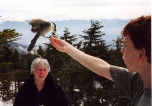
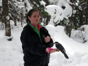
Thank God for Gray Jays!!! What a special treat to have them visit us on the trail! I’m not sure what makes them so special? Is it because the only place we ever find them is on top of a few select hikes,,,? or is it because they are so freaking COOL!!! Wild birds that land on yout hand, (sometimes even on you head) just for a few pieces of trail mix. It’s kind of like having a wild bird that has the personality of a beagle. If Gray Jay’s exist anywhere in the world besides on the top 1/4 of a few select peaks in the whites, I could see where this personality trait could become a real nuisance.
BUT WE LOVE THEM!!

Pasaconaway

Mt. Pasaconaway (4060)


Trail:
Dicey’s Mill Trail
Date:
October 17 1999
Attending:
Gabe, Simone, & John Chicoine
Miles:
4.6-miles to summit 9.2 Round tripTime: 3.75hrs up, 6.75hrs. Total
AMC huts, / shelters / camping site:
Camp Rich
Weather:
Sunny, mid 60’s at base, 50’ish on summit,

“Everybody needs beauty as well as bread, places to play in and pray in, where nature may heal and give strength to body and soul.” John Muir

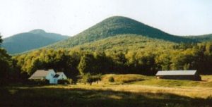
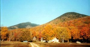
…………………………………………….. These pictures don’t have Passaconaway in them, but they are from the trailhead. And the rest of the hike is just as beautiful.

This is # 29. What a delightful trail. This just might become an annual fall foliage hike. From home it’s 3hrs. to get to the trailhead off Ferncroft road. The parking lot was almost full, (must be a popular fall hike). The lot is shared by the Whitecliff, Wanalaucett and Passaconnaway trailheads. Of the 4.6 miles the first .6 is on an old farm road past beautiful fields and farms nestled in a flat land community surrounded by mountains. At one point we hike on private property that is gated off, (the gate is to stop cars, not hikers), through a large ten acre lawn, and right past the front porch of a beautiful private home. The next 2 miles are a pleasant uphill meander at a constant 5-degree grade. There is an easy river crossings that could pose a possible problem at high water time. The rest of the hike is never any more than a moderate hike with a short 100ft. rock scramble just before the wooded summit.

Every time we came to any steep sections there were always steps at any place that exceeded a 25-degree incline. The woods along the trail near the summit are interesting; there are lots of open woods, even lots of possible tent sites. There is a large lookout about 30 feet from the summit that looks directly over the Pemigewasset wilderness towards Garfield. There are no views to be had from the summit. Camp Rich has a shelter that is totally falling down and a bathroom that is falling apart. The floorboards of the shelter are a mess and no one could ever get a good nights sleep in there. There is a large fire pit at the shelter but you’ll need a fire permit. There is water within 15 minutes of the summit.

(Important note! Bring stones from Camp Rich area to the summit to add to the 5 stone, 8″ tall cairn that marks the summit.)
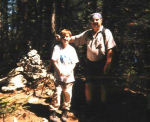
We met a couple that we had a fun time guessing their situation. We saw two elderly couples coming off the summit together, in their 60’s, and we saw another couple in their 70’s at the summit. The only black mark to this entire day was my left knee. The same problem I encountered towards the end of the Carter range backpacking trip two weeks ago, manifested itself within ten minutes of our descent. I couldn’t believe it. Within 10 more minutes I needed some aspirin, and within another ten minutes I stopped to wrap the knee with an ace bandage. Thank God this trail is as easy and often times flat as it is or I would have been in serious trouble. Even the slightest descent irritated my knee. I have got to get on top of this one. On the way home we stopped at a guitar store called Vintage Fret in Ashland NH . That was an awesome store with every imaginable stringed instrument, and even some unimaginable.

EastOsceolo

East Osceola (4156)

Trail: Greeley Ponds Trail, Mt. Osceola Trail

East Osceola (4156)

Trail: Greeley Ponds Trail, Mt. Osceola TrailDate: July 31’ST 1999
Attending: Gabe, Simone, & John Chicoine
Miles: 5.6 total Time: 2.45Hrs up, 5hrs. Total

East Osceola (4156)

Trail: Greeley Ponds Trail, Mt. Osceola Trail
Date: July 31’ST 1999
Attending: Gabe, Simone, & John Chicoine
Miles: 5.6 total Time: 2.45Hrs up, 5hrs. Total
AMC huts, / shelters / camping site:
Weather: Sunny, Low 80’s at base, cooler on the summit.

Gabe is just about to step out of the last steep section of this trail
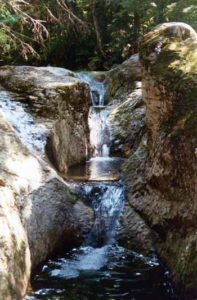
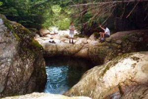
What a beautiful day! This trail leaves the Kancamagus on an easy almost flat hike for the first mile then it starts a moderate stretch for the second mile and finishes very steeply the last .8-miles to the summit. The trail has lots on interesting cliffs overhanging the trail on the last leg and at times the trail is almost hand over hand. The day we were there the sun was burning the dampness off the cliffs so it had a kind of rainforest look and feel to it.
I wouldn’t wish to hike this trail in bad weather, because of it’s steep sections, but most of those sections are in the trees, so you never really feel over exposed, or in danger. There is one steep slide with loose rocks, but it’s only 30 feet or so. Just about the time you’re real tired of the steep pitch, it’s over! You pop out onto a wooded ridge that kind of delivers you the rest of the way to the wooded summit. If you turn right just as you get onto the wooded ridge, (just after scrambling up an eroded gully, there is a nice lookout spot just a few feet down the trail.

We all liked this hike a lot. And although the summit is just a wooded cairn, it had pleasant feel to it. We met another older couple down from Canada that used to hike the Whites with their children and are now finishing up the rest of the 4K’s that can be done as day trips. It’s strange for me to thing that people from Canada are as close to the Whites for day hiking, as we are down here in central Massachusetts. We ate lunch on the summit and started our hike back to the car.

The day, like the hike was short and sweet; we were back in the car by 2:30. I suspect we’ll do this one again. (Probably bringing someone up to the Whites for a short hike.) I’d choose this hike over Mt. Hale even though Mt. Hale is easier and has better views. This was our first Whites trip for our new (to us) 1993 Subaru.

Moriah

Mt. Moriah (4049)

Trail: Rattle River, Kenduskeag

Date: Friday Aug. 30 Saturday, Aug 31’st

Attending: Shawn, Gary, Gabe, Simone and John

Miles: 12Time: 8Hrs.

AMC huts, / shelters / camping site:Rattle River Shelter

Weather: Partly cloudy, high 70’s at the base, 60’s on the summit

# 45 for us.

“The finest workers in stone are not copper or steel tools, but the gentle touches of air and water working at their leisure with a liberal allowance of time”. ..Henry David Thoreau

This trail is a hike of extremes that manages to balance out into a trail worth hiking at least once. We’re glad we did this hike, but we’re not likely to hike this trail again. The Rattle River Trail is the last leg of the AT on the Carter Moriah Range. It crosses Rt. 2 app. 4 miles east of Gorham NH. Our approach to bagging this peak was to drive up to Gorham (4 hours) on Friday afternoon, hike in 1.6 miles from Rt. 2. to the Rattle River Shelter for Friday Night and day hike to the peak on Saturday. This first stretch of the hike hardly breaks a 4-degree incline. The Trail is wide enough for 2 hikers abreast, with hardly a bolder to break one’s stride. The temps were cool, but the humidity was extremely high from the recent rains. We made it to the shelter in 45 minutes. What a nice place to spend the night. The shelter could sleep 6 to 8, and has a half dozen tent sites. Several of the sites are along the side of Rattle River next to one of the most awesome basins 12Ft. across and 7Ft. deep. Plan to get wet! This basin is impossible to resist. We couldn’t! (About 10 minutes farther up the trail is another irresistible swimming pool and water slide.) We met an elderly lady (Mary) that’s a real mile monster. She’s completed section hiking the AT, The Long Trail, the New England 4K’s and more. She refers to herself as a trail snail, but we never caught up to her and she was hauling a full pack. We met Rolling Stone, (a North to South) through hiker, enjoying his experience. I fear he’s running a bit late, but our best wishes go with him in hopes that he makes his goal to finish his quest by Christmas. Gary had a surprise for the evening; he packed enough dry wood up to the shelter for an evening fire. Simone and I opted to sleep in the shelter with Mary and Rolling Stone.

After a relatively sleepless night for all of us, Gary awoke to catch a glimpse of a fishercat on the side of the river looking for breakfast. Our breakfast consisted of the usual bag of oatmeal. We packed our daypacks for the trip, and stashed the backpacks in the shelter. The first mile after the shelter is very moderate, but as with every 4K, eventually you’ve got to pick up the elevation somewhere. Once this trail starts it’s assent, it never lets up for the next 2 miles. (It’s almost stairway steep). Thank God for the cool morning temps and the cloud ceiling that hadn’t burnt off yet. The last 1.6 miles on the Kenduskeag are moderate, but by the time we got to this section I was beat and every steep section took more than I wanted to give.

The last tenth of the trail to the peak is a rock scramble to an open knob about 20 ft. in diameter. We were really in need of the relaxing hour we spent on the summit enjoying the 360-degree views. We met a family of 5 that hiked up the Carter Moriah trail. The Father was just finishing his 48, and the children (ages 10 to 13) were hiking their first.

Our descent was just as I expected, tough on the knees. The flat section of the trail was a relief we all needed. Once we hit the flats we all zoned out and headed full stride for the shelter. Swimming in the basin was the driving motivation. Cold water! Full emersion! Total renewal! Every hot spot, sore joint, and tight muscle washed away in just a few minutes of exquisite refreshing mountain river water. The hike out to the car seemed like it was over in a blink of the eye and we never broke a sweat.

Tripyramids

“We are not truly civilized if we concern ourselves only with the relation of man to man.
What is important is the relation of Man to all of Life.”
Rachael Carson

Mt. Tripyramid Middle (4110)

Mt. Tripyramid North (4140)


Trail: Sabbaday Brook Trail.
Date: Sunday 9/31/01
Attending: Shawn, Simone and John
Miles: 12 Time: 7 hours round trip
AMC huts, / shelters / camping site:
Weather: Partly Cloudy, 60’s at the base, 40’s on the summit.

Just the three of us, But wait! Not the usual three. “John, Simone, and Shawn? Where’s Gabe? 40 mountains and Gabe has been with us on every one! We have never bagged a 4K without Gabe. We’re out of sync. Gabe just had to fulfill his commitments with Royal Rangers. This means Simone and I will have to bag these peaks again to sync Gabe back up. By-The-By, these were #’s 40 and 41. Sabbaday Brook Trail is a great way to bag these peaks.

Although there were lots of river crossings and the trail could definitely be impassable in high water conditions. Other than the river crossings, (which got me calf deep with both feet on the second to the last crossing back to the car.) We rate this trail 90% easy to moderate. The other 10% is steep but not unreasonable except for about 50ft. of slide that was a bit of hands and knees. I guess ¼mile of steep hiking to bag a 4K is not a bad deal. We backtracked over the Tripyramid trail to Middle and then North peak. The peaks themselves aren’t anything spectacular, North peak is entirely wooded with only a limited view of Middle Peak off a spur next to the summit. Middle peak is wooded but less sparse than North Peak, so there are only some views over and through the treetops. I lifted Simone up a few inches so she could see Mt. Osceola. The Sabbaday Brook Trail is most definitely the “Road less traveled” we only saw 2 other people on this trail but was saw 12 other people on the Tripyramids Ridge trail hiking from the WaterVille Valley side. There were very few places to set up a camp site on the lower section of the trail but above the slide we saw several good sites; Not that I would have wanted to carry a pack up the steep section of this trail. There is plenty of water up to the last ½mile from the Tripyramids ridge trail. We managed to get back to the car by 4:00 and meandered back up the Kancamagus Highway taking pictures at roadside stops like tourists in foliage season. We Were!

Read about other Tripyramids trips:

Tripyramid1

Mt. Tripyramid Middle (4110)

Mt. Tripyramid North (4140)

Trail: Sabbaday Brook Trail.
Date: Saturday 9/22/02
Attending: Shawn, Gabe, Simone and John
Miles: 12 Time: 7.5 hours round trip
AMC huts, / shelters / camping site:
Weather: Partly Cloudy, 70’s at the base, 50’s on the summit.

One more time, at least for a few of us. This was a catch-up hike. Now that we’re closing in on the final 3 hikes to complete the list, we had to bring Gabe back in sync with Simone and I. After all this work together there was no way I was going to have a partial celebration on # 48.

What happened to this Hike! I thought this was one of the easy ones. Not that there are any “easy” peak but in our memory we seemed to have painted this hike a bit different than it went on this trip. Quite possibly because we knew we’d have to bag this peak twice regardless of how long it took. Maybe it was the humidity or maybe it was just the end of a very long week but Simone and I were dragging our buts up the steep sections of this trail. The plan was for Simone and I just to hike up to North Tripyramid and Shawn and Gabe were to bag Middle and then backtrack to meet us on the north peak. As it turned out Shawn and Gabe bagged both Middle and South peaks before they doubled back. Simone and I just enjoyed a long (but viewless) rest on North Tripyrmad. The clouds never left the peaks while we were up there but the sun did have its appearance’s throughout the day. The hike started out with a bit of an unexpected hitch the parking lot and trailhead was under construction and closed until farther notice. Our other rout to the peak would have been to hike the Pine Bend trail just a ½ mile up the Kanc but a much harder hike with far less water. I wasn’t interested in dealing with the extra effort so we parked the car in an overflow lot for Sabaday Falls and hiked the Sabaday trail as planned. The Parks department was in the process of outfitting the falls area was with all new railings.

This hike seemed to want to take its toll in injures. Shawn hit the deck and bruised the base of his hand just below the palm and Simone slipped crossing one of the many riverbeds and dislocated her pinky at the second joint. Her finger was bent at a 90-degree angle at the joint. As quickly as we understood what was wrong, I popped her pinky back into it’s joint. We immediately wrapped her hand in a cold water soaked bandanna and Simone took 800 milligrams of Motrin. We took a few moments to soak the hand at every river crossing and the Motrin cut the pain to within a tolerable level. We had homemade apple pie waiting for us in the car, just one more reason we wanted to get off the trail. (One last interesting event). Only in the Whites can you find people snorkeling in the gorge beneath a 20Ft. water fall. (Like I said,,, Sabaday Falls was closed to the general public while construction was going on.)

Pierce1

Matthew 6:26 – Look at the birds of the air; they do not sow or reap or store away in barns, and yet your heavenly Father feeds them. Are you not much more valuable than they?…. (God sends Simone and I to the tops of 4K’s just to feed the Grey Jay’s for Him.)

Mt. Pierce (4310)

Trail: Crawford Path
Date: March 8’th 2014

Attending: Carrie, Simone, & John Chicoine

Miles: 6-mile Round trip Time: 2hrs up, 4hrs. total

AMC huts, / shelters / camping site:

Weather: Mid 20’s at base, 10’ish on summit, 20-40Mph. wind, bright and sunny


Our old standard winter hike never fails to delight and Mt. Pierce did it again; In Spades! What a wonderful day on this spectacular Southern Presidential summit. I know way to well to make light of any 4K hike and I don’t recommend anyone else does either; all that said, this is without a doubt the most pleasant stress free 4K hike in the whites and my top pick as a first winter hike. But! The summit is always icy and I would never hike it without traction devices.

Yea Carrie! (the one with the E-mail address “I-Want-warm-weather”) On your first winter 4K! We never thought we’d ever see you on a 4K, let alone a winter 4K. We’re really glad you did this one with us. Especially because we couldn’t have bought a better day. Just the right temps for a real winter hike, perfect snow conditions for traction devices, and Grey Jay’s!) If ever there was a great day to hook someone on fare weather winter mountain hiking.

We weren’t the only ones with the idea to take advantage of the great day; There had to be at least 40 cars in the lot when we got there at 10:am. (We took the last spot to squeeze a car into.) On the summit we ran into an AMC group of 17 people, (Mostly “OLD people”, like they were all 60’ish.)
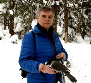
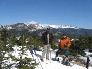


Speaking of old people,
there’s one now!

To the left!


Matthew 6:26 – Look at the birds of the air; they do not sow or reap or store away in barns, and yet your heavenly Father feeds them. Are you not much more valuable than they?


Always remember… To wade about in the cold water of a swift running snow melt brook in the White Mountains is an experience worth taking advantage of at every opportunity that presents itself. It washes away more than the sweat.

Links to all the pierce hikes:

  1. Pierce 1 – (2014, Carrie, Winter)
  2. Pierce 2 – (2013, Ben, Winter)
  3. Pierce 3 – (2010, Tyler, Winter)
  4. Pierce 4 – (2000, Gabe, Winter)
  5. Pierce 5 – (2002, Shawn, Gabe, Winter)
  6. Pierce 6 – (2004, Gary, Shawn, Gabe, Winter)
  7. Pierce 7 – (2004, Dale, Chris, Fletcher, Gabe, Spring)
  8. Pierce 8 – (2005, Shawn, Gabe, Winter)
  9. Pierce 9 – (First summit, 1999, Winter)

Pierce2

“No synonym for God is so perfect as Beauty. Whether as seen carving the lines of the mountains with glaciers, or gathering matter into the stars, or planning the movement of the rivers.– still all is Beauty! ” . . . John Muir

Mt. Pierce (4310)

Trail:
Date: April 21 2013

Attending: Ben Leveillee, Simone, & John Chicoine

Miles: 6-mile Round trip Time: 2.75hrs up, 4.5hrs. total

AMC huts, / shelters / camping site:

Weather: Mid 20’s at base, 10’ish on summit, 20-40Mph. wind, bright and sunny

Simone and I have this unspoken rule that any of the boys we work with to help get their Gold Medal, should climb at least one 4000 footer before they climb the podium, and this is Ben’s. And!!! If the mountain just happens to have snow on it when we do it, that’s even better!

Congratulations Ben (On your first 4K and the GMA!!!)

What can I say about this hike… Just enough challenge on the trail to make it worth doing and just enough ferocity in the wind and the cold to make it memorable. The views are always just spectacular enough to renew our spirit and remind us to make more plans to do it again. For those that have never experienced such beauty,,, the understanding of why someone would drive 7 hours, hike up a relentless trail for 2.5 hours, and again down for 2 more hours, escapes them. For those that have experienced such beauty,,, the understanding of why someone wouldn’t drive 7 hours, hike up a relentless trail for 2.5 hours, and again down for 2 more hours, escapes us.


I can’t help but mention,,, This was Simones birthday wish… To stand again on the top of this summit on her birthday, and breath the cold fresh air that can only be found on a winter summit in the White Mountains. (I’m smart enough not to mention which birthday she was try into assure herself,,, that she’s still got it.)

“Climb the mountains and get their good tidings. Nature’s peace will flow into you as sunshine flows into trees. The wind will blow their own freshness into you, and the storms their energy, while cares will drop off like autumn leaves.”
……. John Muir

Ben, I don’t know if you’ll ever find this page on our web site,,, But if you do, It was great having you along on this hike. Just like the GMA, Just like it is with everything worth doing, it’s not the event that is of the greatest importance; It’s how that experience changes you. It’s who you become from the experience that is of the greatest value. And when we seek after experiences of such great challenge, such great goodness, and such unspoiled work of the hand of God,,, We become more like Him.

This was just one of so many great hikes in the Whites, and so many great challenges you can find regardless of what season you get up here. Hopefully we’ll have many more great hikes. Even more so,,, Hopefully this is just the first of a lifetime of great hikes you’ll experience.
“Men go back to the mountains, because in the mountains they must face up to the challenge of nature. Modern man lives in a highly synthetic kind of existence; rarely does he test all his powers or find himself whole. But in the mountains, the character of man comes out.”
……. Abram T. Collier


One thing Simone and I learned that totally took us by surprise; As we drove by the old lookout spot for the Old Man in The Mountain, we could no-longer have the great pleasure of introducing our old friend to this new White Mountains hiker. It really was an emotional moment. We used to get so excited every time we drove by, twisting our necks to grab a quick glimpse; “There He Is” someone would always shout… Like it was the first time we ever saw him. And what was worse, Ben had never even heard of him. How useless were our words to try to impress upon Ben just how truly majestic that old man was.

Always remember… To wade about in the cold water of a swift running snow melt brook in the White Mountains is an experience worth taking advantage of at every opportunity that presents itself. It washes away more than the sweat.

Links to all the pierce hikes:

  1. Pierce 1 – (2014, Carrie, Winter)
  2. Pierce 2 – (2013, Ben, Winter)
  3. Pierce 3 – (2010, Tyler, Winter)
  4. Pierce 4 – (2000, Gabe, Winter)
  5. Pierce 5 – (2002, Shawn, Gabe, Winter)
  6. Pierce 6 – (2004, Gary, Shawn, Gabe, Winter)
  7. Pierce 7 – (2004, Dale, Chris, Fletcher, Gabe, Spring)
  8. Pierce 8 – (2005, Shawn, Gabe, Winter)
  9. Pierce 9 – (First summit, 1999, Winter)